As you stand at this cemetery’s gate, south of the old city of Edinburgh, you are at the ridge of the ancient Burgh Muir. Here, from the earliest times to the Jacobites, were common grazings and the haunts of vagrants. Kings hunted over the moor and its forests, and assembled armies there. By 1513, enclosed by its FloddenWall, Edinburgh could only expand upwards. Overcrowding increased and so eyes and minds turned to the north and, based on James Craig’s plan, the new town was growing, across the Nor Loch, by the turn of the 18th Century.

Soon, the richer townsfolk, again seeking even more space—and some perhaps wanting to turn a coin—built George Square, drained the Burgh Loch (now the Meadows), and longingly looking even further out from town, thought of developing the south-sloping land of the Burgh Muir. Sir Thomas Dick Lauder obtained an enabling Act of Parliament (1825) and, under rigorous conditions, planned to arrange feus on: ‘. . . the lands of Grange, called St Geillie Grange, with the Manor Place of Grange, Houses, Biggins, Yards, Orcheards, Dovecoats . . . also . . . arable land of Schynes . . . with Houses and Biggins now waste, and Pertinents thereof, lying betwixt the other land of Saint Geillie Grange on the West and South Parts, and the Common Muir of Edinburgh on the East and North Parts . . . ’ At this time, housebuilding had already started further south-west on the lands of Canaan (areas of present-day Morningside).

In 1753, Edinburgh’s urban population was about 48,000 and this had increased to just over 90,000 by1801, the year of the first official census. In 1851 the population of Edinburgh exceeded 200,000. Even at the start of the 19th Century, the city’s old churchyards, all in heavily populated neighbourhoods, and some having been extended more than once, were more than full. Often bad maintenance, and tombs with encircling protection against body-snatchers, allowed filth to pile up. To meet the problems, private companies made cemeteries near the then outer limits of Edinburgh.
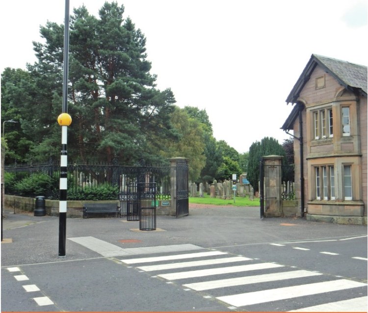
Grange Cemetery was established in 1847 by the Southern Cemetery Company Ltd. on land acquired from the Dick Lauder family of the Grange Estate. Designed by David Bryce the architect, the site occupied an open space of more than 12 acres and was built on a rectangular pattern around central vaulted catacombs which are built into the crest of the hill. Bryce also designed the lodge, modified by J.G. Adams in 1890, and a mortuary chapel which was never built. The cemetery lies on Beaufort Road and has been expanded to Kilgraston Road. It contains about 6,250 burial plots and is still in use today Five cemeteries were opened from 1843 to 1846, and the largest, the Southern or Grange Cemetery, owned by the Edinburgh Southern Cemetery Company, was able to receive its first interment, that of Dr Thomas Chalmers, in June 1847.

Grange Cemetery, designed by the architect David Bryce, was planned to provide for ordinary burials and for lodgements in vaults. However, fashions changed quickly. The vaults rapidly became unpopular, as monuments, easily seen, and for some so readily exhibiting a conspicuous connection to substantial wealth, became voguish. An intended mortuary chapel was never erected, but there was an extension westwards in the 1920s.
It is, maybe, interesting to note that cremation became available in Edinburgh in 1929. Nevertheless, the Grange Cemetery remains open for all who wish to pay respects to forebears and for the use of families possessing lairs. In 1976 the Grange Cemetery was taken over by the City of Edinburgh District Council.
Gerald H. France – 1999