
The above is the preface to a loose-leaf booklet produced in 1991 by former chairman of the Grange Association and cartographer Robert Bartholomew. One of the remaining copies of the booklet has been scanned and is reproduced here.

CONTENTS LIST (please click on the item below)
A fuller description of the maps is found on page 2 of the introduction.
Many of the maps are reproduced with consent from the National Library of Scotland
Map number. ____ Map
_________ Introduction
1________ Valeso 1590
2a. ______ Blaeu 1654 and Adair 1735
2b. ______ Laurie 1766, Armstrong 1773 and Taylor & Skinner 1775
3a.______ Knox 1812
3b.______ Kirkwood 1816
4._______ Kirkwood 1817
5. _______ Stewart 1820
6a _______Grainger & Miller 1825
6b _______Cousin 1851
7. _______Rayburn 1864
8. _______Lancefield 1851
9. _______Lancefiled 1861
10_______Lancefield 1871
11_______Bartholemew 1891
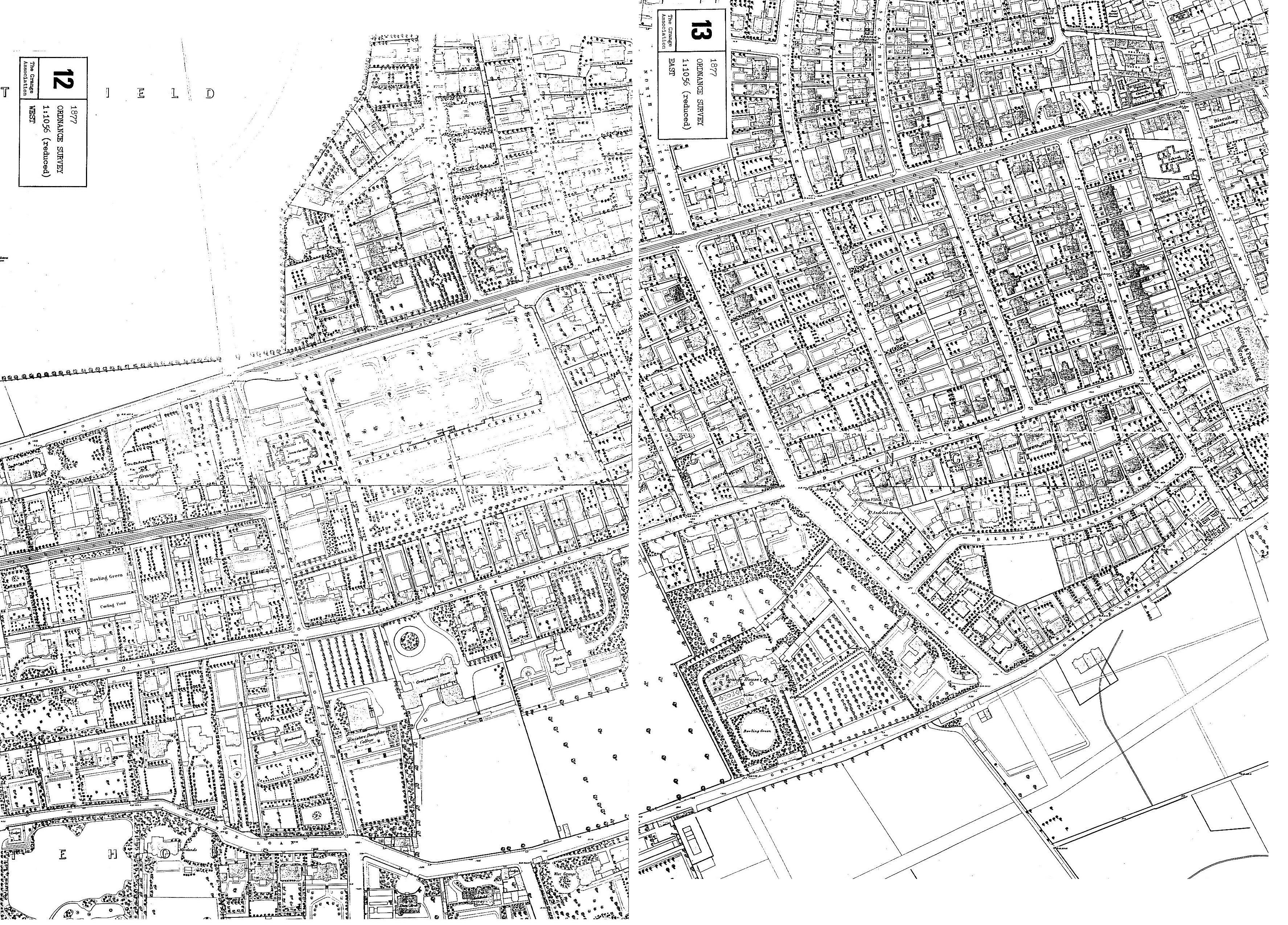
12_______Ordnance Survey 1877 (West)
13_______Ordnance Survey 1877 (East)
12/13____Ordnance Survey 1877 (Combined)
14_______Ordnance Survey 1896 (West)
15_______Ordnance Survey 1896 (East)
14/15____Ordnance Survey 1896 (Combined)
16_______Ordnance Survey 1932 (West)
17_______Ordnance Survey 1931 (East)
16/17____Ordnance Survey 1931/32 (Combined)